Crew ; HIKE GANG..(10) ( Ranil Hemantha,Nilmini Sadamali,navoda,chathurika,muranga.Pasan,Sauya,Dilesha and other 2 )
Accommodation; Camping top of the kabaragala
Transport; By Bus
Activities; Hiking, hobby, photography, mind relax, Nature Exploring
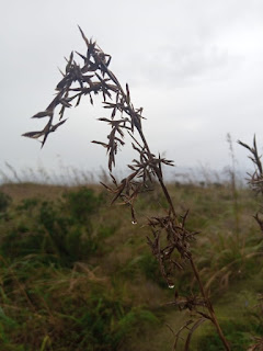
Weather; Rainy day
Route;From Kandy travel along the Kandy Road passing Peradeniya up until Gampola. Turn to the Gampola – Craighead Road and travel along this route until Dolosbage. The Kabaragala trail starts from Maryville Junction in the Nawalapitiya – Dolosbage Road
Notes and Special remark;
follow the Google Map route
Take enough water
Do not go there during heavy rainy days
This is a little bit difficult hike
Recommended for young crew hikes
Take food and stuff
Do not pollute the environment
Parking is available near the trailhead
Use the comfortable route as it gives just a 3-hour hike
Kabaragala is a mountain situated in the Dolosbage mountain range in the central province of Sri Lanka. It is renowned as the highest mountain peak in this range. Kabaragala is approximately 1506 meters in height. It is very much similar to Horton plains due to its flat terrain at the top and the huge drop similar to the World’s End. The highest point is at the right of the terrain.
Activities; Hiking, hobby, photography, mind relax, Nature Exploring, Temple
Weather; Clear sky
Notes and Special remark;
Take enough water
the Google Map route
This is a very easy hike
Recommended for family hikes
Do not pollute the environment
Parking is available near the trailhead
Use the comfortable route as it gives just a 10-minute hike
kodigala Hill Hike (1518m)
For those who are like to take an adventure experience, it is a nice place for beginners. it is an easy task to achieve and it is a nice view at top of the kodigala, it takes a 10-15minute climb with step
Author; Ranil Hemantha
Sri Lanka is unique for its unspoiled beauty. Buddhism was the cornerstone of our rich history. So it’s no surprise that there will be ancient temples on top of mountains, may be swallowed up by the ocean and in each and every city. That is our culture.
Driving on the Southern highway towards Colombo, a few miles after the Kalutara exit and a mile or two before the Panadura exit, on the right-hand side on top of a mountain the image of a Buddha statue adds tranquillity to the already green and majestic mountain tops. This is the Buddha statue of the Kodigala Aranya. Getting there is not an issue if you know the name of the place since it’s on Google maps and it will take you right to the entrance of the temple.
If you are not a google maps person, finding the place would be a bit tricky. After taking the Panadura exit, travel on the Panadura Horana road towards Imbula road. It was about a 20 minutes drive from the Panadura exit during a time there was no traffic.
The temple consists of two areas. The lower area has the bo tree and places to worship. Thereafter it’s a 10-minute climb to reach the upper level where you see the majestic Buddha statue. This area is on top of a mountain
, so the view is spectacular. The atmosphere is ideal if you want to spend time in stillness. Not sure why there aren’t too many people visiting this temple, but for those who want peace and quiet while they worship or just enjoy the surrounding, this is ideal. The 10 minutes climb is a little steep, but there are steps except for the last lap where the steps are from what was left from the ancient temple. According to the Caretaker, there are many folk stories about this ancient temple. Some say that long years ago, people could hardly travel to the upper area of the temple due to strange and mysterious happenings. Later on in the recent past bhikkhus have used the upper area for meditation and have invoked a lot of blessing and with that, the mysteries of the past have vanished.
I recommend this detour from the Southern Highway to the Kodigala Aranya!!
Activities; Hiking, hobby, photography, mind relax,
Nature Exploring
Weather; Rainy day
Notes and Special remark;
Do not ever follow the Google Map route
Take enough water
Do not go there during rainy days
This is a very easy hike
Recommended for family hikes
Take food and stuff
Do not pollute the environment
Parking is available near the trailhead
Use the comfortable route as it gives just a 10-minute hike
Peacock Hill Hike (1518m)
Author; Ranil Hemantha
and Ranil Hemantha. we are planning a hike on a Saturday with Tharindu dananjaya and we came through kurunagala to kothmale for a hike but unfortunately, we couldn’t go to the destination due to the rain. Then we thought to go to Peacock. But couldn’t capture a single photograph due to heavy mist and rain. Hence I also agreed with tharindhu to go to Peacock via a different road which shows in the Google Map.
We ride along the Mahaweliseya from the Kothmale dam and went as per the direction of tharindhu because he has come many time there. However, we realized that this route will get finished at some point and we have to do a small hike to get entered into the actual route. There are two main routes to come to the Peacock and the below are the correct and easiest routes. The route which we followed was the Old Track to Peacock and now it was fully covered with a thick Forest.
Route 1
From Gampola to Nuwaraeliya roadà Turn right from Paradeka junction and come to New Peacock Tea Factory then turn Left side from there and proceed about 4km to Doragala Tea Factoryà Then turn left to the Peacock hill which was situated near the Peak lime houses.
Route 2
From Kothmale DamàCome along the Pussellawa road up to the Kothmale Pagoda junctionà Turn left to the Kothmale Maha Seya Road and proceed about 4.5kmà and will come to the Doragala Tea Factoryà Then turn Right to the Peacock Hill
Route 3
From Nuwaraeliya road after passing Pussellawa turn right to Rothschild Tea Factory road near Delta Gemunupura College, and proceed up to the Tea Factory and take the road to Monaragala Buddhist Center and there turn right and go to the end of that road, this road will end up at some point mid of a tea estate and a small forest patch. Then park your bikes there and take the forest footpath and reach the village near the peacock hill. This is a bit tough hike and this is the route shown in Google Map. Hence DO NOT USE THIS ROAD BY FOLLOWING GOOGLE MAP. This is a 4WD road and very difficult to ride through the narrow bend and gravel road.
Both routes will meet at Doragala Tea Factory and then precede up to the Trailhead. From the trailhead, there is about a 1km hike to the mountain and select the left side footpath when you entered the Pines patch.
There are communication towers such as SLT, Dialog, Etisalat, and Airtel. Camping is prohibited over there and a Pagoda will be built on a peak in the near future.
Thursday, November 4, 2021
HULU GAGA (දුම් බර මිටියාවතේ රිදී සළුව)
1. Hulu gaga fall & Bridge
Hulu gaga fall is another beautiful fall created by Hulu gaga. It is flowing down under the Hulu gaga Bridge near the Hulu gaga town area..it is 75 m in height. This bridge is 160 - 170 years old.
2. Jodhu Alla ( Depth Alla)
When I drove to thawalamtanna gs area (Hulu gaga - Panvila Road), We had seen two waterfalls are flowing down in parallel. it is called jodu alla. it is 45m in height.
3. Thaliya watinu alla
Then We had gone allakolla estate. This state maintains by state plantation control. It maintains well. The road is also well. We were lucky to take full view photographs of Thaliya watinu alla in distance. But hard to reach the pond. It is another beautiful waterfall generated by the Hulu gaga. It is 53 m in height. But water flow is low because of the Mini hydropower project. We heard from rural society, there is a cave on the rock & you can go behind the fall. this was a ended of our hulu gaga tour, we will be back with another marvelous journey........